|


| |

AgGPS EZ-Map Software
 Trimble's
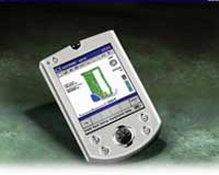
AgGPS® EZ-Map software is easy-to-use and runs on handheld Pocket PCs, such as
the Compaq iPAQ. It is fully featured mapping software, which gives maximum
benefit for minimum investment.
AgGPS EZ-Map can be used for application logging, field mapping,
point, line, and area feature mapping, sampling, scouting, and planting. With an
AgGPS 214 high accuracy RTK receiver, growers and contractors can use the
software for topographic mapping.
Coverage logging maps provide proof of the job quality to customers and can
also be used for environmental or other record keeping purposes.
The AgGPS EZ-Map software has the same look and feel as the advanced
AgGPS FieldManager software that runs on the AgGPS 160 Portable
Computer, and AgGPS 170 Field Computer. This allows you to easily
transition to these products when you need features like variable rate control
and planting, barcode or weather sensor data logging, advanced guidance
patterns, and a rugged waterproof field computer.
Key features:
 |
Coverage logging shows you skips
in material application |
 |
Fix skips before leaving the field
to increase crop yields, and avoid costly call-backs |
 |
Automatically control coverage
logging with an external switch |
 |
Map precise areas and locations of
weed, pests, tile lines, or other features |
 |
Create your own personalized data
dictionary of features and attributes for point, line, and area mapping
|
 |
Display background shapefiles and
geo-referenced BMP/JPEG files |
 |
Includes ESRI ArcExplorer office
software for printing maps |
 |
Data saved in industry-standard
ESRI Shapefile format |
 |
Compatible with most GPS receivers
and guidance systems |
|
